Problem solver
I enjoy problem solving and optimization. I leverage code to automate workflows and perform complex spatial analysis. My tools of the trade include Python, C# and JS.
Hello, this is where I have links to some projects!

Stock price charting utilizing Django and Yfiance library.

ESRI Arcade Code Store, for editing and sharing.
Instant GeoJSON Visualization with Leaflet.

Water Polo play recorder. Allows users to save and record plays!
Web maps!
My Maps
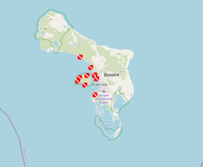
This is a dive log web map of my vacation to Bonaire.
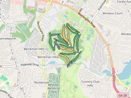
Augusta National 2024 event stats.

Weather web application uses leaflet lat lon function and an api to gather local weather information.

Home price per sqr. ft. comparison calculator. Realtors often use comps to determine a estimated price for a home.
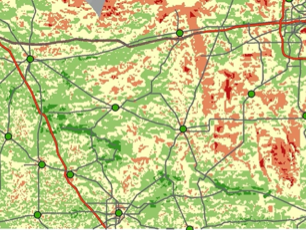
Site selection analysis in Arcgis model builder to determine highly suitable solar farm locations in Florida.
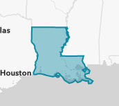
Esri story map with geospatial data to examine a rural Louisiana community.

Fun browser media player with shuffle!
Work Experience
-
S3 - TECO
GIS Systems Analyst
- Automated map production workflows, saving the company over 1,000 hours annually by eliminating manual, time-intensive processes.
- Designed and implemented robust data pipelines to integrate disparate systems, ensuring timely data transformations, cross-system consistency, and data integrity.
- Led custom GIS development projects, including ArcGIS Enterprise enhancements, translating business requirements into actionable solutions.
- Optimized and scaled GIS services, performing capacity planning to ensure high availability and performance.
- Enabled self-service capabilities by creating user-friendly data pipelines, empowering business users to access and manage data independently.
-
NV5
Geospatial Analyst
- Developed custom C# extensions for ArcGIS Pro, reducing repetitive tasks and saving each analyst an average of 20 minutes daily.
- Leveraged Python and ArcPy to automate geospatial workflows, boosting productivity while documenting tools and limitations to enhance collaboration and knowledge sharing across teams.
-
UDC inc.
GIS Technician I
- Coordinate with team members and off-shore partners to verify quality of 3-D rendered structural models to ensure client needs are met in a timely fashion
- Explore means of productivity enhancement though python and excel.
-
Northwest Florida Water Management District
OPS-GIS Analyst
- Assisted in the production of an extensive catalog of shapefiles that represent features of the greater Northwest Florida Area from remote sensed optical aerial imagery.
- Adapted a system that utilized Survey123 to capture real-time data in the field.
Education
-
University of South Florida
Masters level course work
- Advanced GIS - implement model builder in ArcGIS 10.8 to replicate work flows, perform raster data tasks, suitability analysis and network analysis.
- Programming for GIS utilizing python to create features and create work flows without a GUI to harness geospatial operations available in ArcPy.
-
Florida State University
Bachelor of Science in Environmental Science
- Wholistic education with courses from biology, environmental law, hydrology, GIS, and various geosciences.
- Gained practical knowledge in environmental fieldwork and environmental law including environmental resource permitting.
-
Broward College
Certification in Geographic Information Systems (GIS)
- Courses in human geography, GIS applications, 3-D rendering and remote sensing.
Let's solve problems!